Guide
Best stops between Reykjavík and Vík
Every worthwhile stop on the 187 km drive from Reykjavík to Vík — waterfalls, viewpoints, hot springs and food — with the order you'd hit them and how long each takes.
Key facts
- Total distance
- 187 km / 2.5 hours pure driving
- With stops
- 6–8 hours realistic
- Number of major stops
- 8 worth stopping for
- Fuel availability
- Hvolsvöllur (km 105) is the last big station
- Best lunch stop
- Skógafoss or Hvolsvöllur supermarket
The 8 stops in driving order
1. Hveragerði — km 45
Geothermal village set in steaming hills. The 2-hour hike up Reykjadalur to the hot river is one of Iceland’s best moderate hikes — wade in the warm water and back. Hot Springs Walk is open year-round but icy in winter; cleats help.
If you skip the hike, the Greenhouse Café and the geothermal park at the edge of town are 30-minute stops.
2. Seljalandsfoss + Gljúfrabúi — km 130
The headliner. Park, walk to Seljalandsfoss (60 m waterfall you can walk behind), then walk left along the cliff base 1 minute to Gljúfrabúi — a second waterfall hidden inside a slot canyon. Most travellers miss the second one. ISK 1,000 parking.
Bring waterproofs. The spray drenches you.
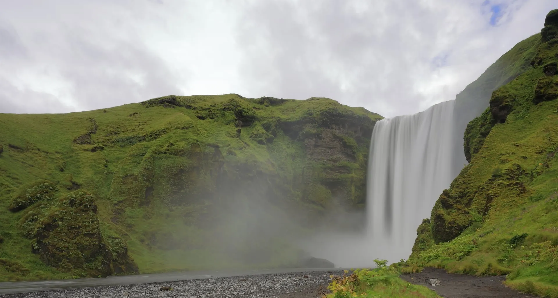
3. Skógafoss — km 155
25 km east of Seljalandsfoss. 60 m wide, 25 m tall. Climb the staircase up the side for a top-down view. The river feeding it (Skógá) drains the southern Eyjafjallajökull glacier.
Skógar Folk Museum next door if it’s raining.
4. Sólheimajökull glacier viewpoint — km 165
5-minute walk from the car park to a viewpoint of the retreating glacier tongue. Free. Guided ice-climbing and glacier walks start from this car park (book ahead).
The glacier has retreated 1.2 km since 2000 — visible markers along the path show old terminus positions.
5. Dyrhólaey — km 175
The dramatic peninsula 10 km west of Reynisfjara. Drive up to the upper viewpoint for the lighthouse + sea arch + view back to Reynisdrangar. The lower section closes for puffin nesting mid-May to late June.
The wind here is consistently 10–15 m/s; hold onto kids and don’t approach the cliff edges.
6. Reynisfjara — km 180
Black-sand beach with hexagonal basalt columns (Hálsanefshellir cave) and the Reynisdrangar sea stacks offshore. The traffic-light safety system warns when sneaker waves are dangerous — observe it. Stand on the basalt steps, never with your back to the sea, and keep 15+ metres from the surf line.
7. Vík — km 187
The southernmost village. Stop for a proper meal at Halldórskaffi or Suður-Vík. Black-sand beach with views back to Reynisdrangar (the Vík side is safer than Reynisfjara for kids).
Optional sidetracks
- Kvernufoss — a quieter waterfall 5 minutes drive past Skógafoss, accessed by a short hike. Less crowded.
- Eyjafjallajökull visitor centre — 5 minutes off Route 1 at km 145. The 2010 eruption story, free for short visits.
- Reynisfjara cliff path — for the brave, the cliff top above Reynisfjara has the best panoramic of the sea stacks.
What you don’t have time for in a single day
- Þórsmörk (4-hour F-road detour from Hvolsvöllur, summer only)
- Landmannalaugar (5+ hour F-road detour from Hvolsvöllur, summer only)
- Vestmannaeyjar (Westman Islands) (ferry from Landeyjahöfn, full day)
- Walking sections of the Skógar–Þórsmörk trail (multi-day hike)
Save these for a 5+ day trip with overnight bases.
See also
- Reykjavík to Vík route — the route page with driving notes
- 3 days in South Iceland — extends this drive to Jökulsárlón
- Things to do in South Iceland — the full overview
Frequently asked questions
Can you do this in one day?
Yes — most South Coast day tours do exactly this and return to Reykjavík by evening. It's a full 10-hour day. Splitting with an overnight in Vík is more enjoyable but not necessary.
What's the single best stop?
Seljalandsfoss + Gljúfrabúi together — you walk behind one waterfall, then 1 minute away there's a hidden waterfall inside a slot canyon (Gljúfrabúi). Most travellers miss Gljúfrabúi because it's not signed from the main lot.
Should you stop at Reynisfjara if it's stormy?
Yes — but stay well back from the water line. Sneaker waves are most dangerous in big swell. The traffic-light warning system tells you the current risk; red = stand on the rocks at the edge, never near the surf.
When does Dyrhólaey close?
The lower section (closer to the lighthouse) closes mid-May to late June for puffin nesting. The upper viewpoint stays open. Outside that window everything is accessible.
Where's good for lunch?
Lambafell café at Skógafoss (basic but views), Hvolsvöllur supermarket for a picnic, or wait until Vík for a proper restaurant (Halldórskaffi or Suður-Vík).
Can you walk behind Seljalandsfoss in winter?
Sometimes. The path closes when icy — usually November through March on most days, but check at the car park. The waterfall is visible from outside without walking behind.